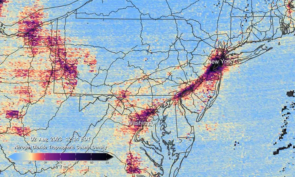
NASA shows images from Tempo
image for illustrative purpose

Washington: US space agency NASA has released the first data maps from its new pollution-monitoring instrument, launched to space earlier this year.
From its orbit 22,000 miles above the equator, NASA's TEMPO, or Tropospheric Emissions: Monitoring of Pollution, is the first space-based instrument designed to continuously measure air quality above North America with the resolution of a few square miles.
Launched in April aboard a Maxar Intelsat 40e satellite on a SpaceX Falcon 9 rocket, TEMPO makes hourly daytime scans of the lower atmosphere over North America from the Atlantic Ocean to Pacific coast and from roughly Mexico City to central Canada. The primary instrument is an advanced spectrometer that detects pollution normally hidden within reflected sunlight.
The first pollution maps show concentrations of nitrogen dioxide gas from pollution around cities and major transportation arteries of North America.

