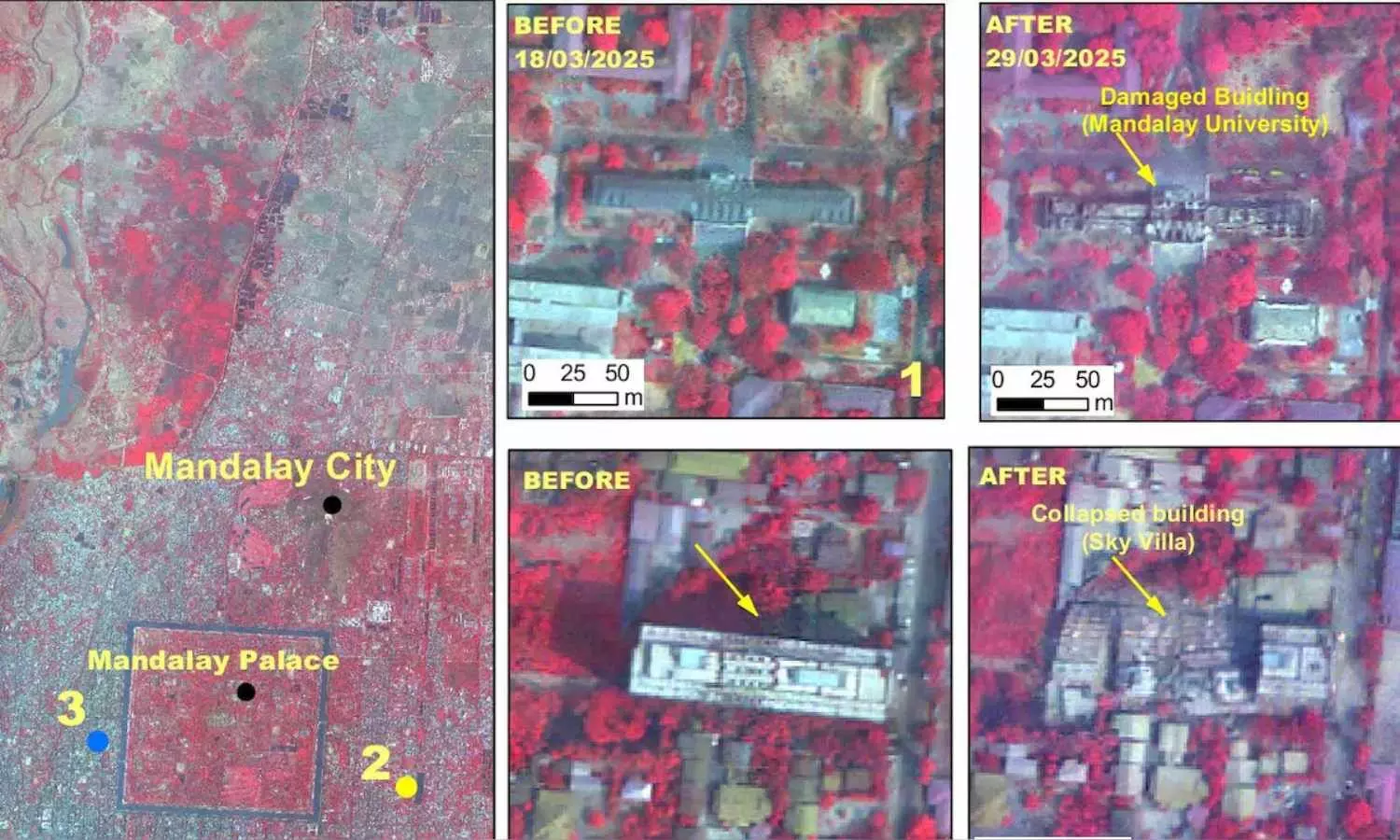
ISRO Satellite Image Shows Damage Caused By Myanmar Quake
ISRO on March 31 released images showing extensive damage from the 7.7-magnitude Myanmar earthquake, including collapsed buildings.
ISRO Satellite Image Shows Damage Caused By Myanmar Quake

The Indian Space Research Organisation (ISRO) has unveiled satellite images that reveal the extensive destruction caused by the 7.7-magnitude earthquake that hit Myanmar, sending shockwaves through neighboring countries last Friday.
On its official website, ISRO noted that the damage assessment was made through a rapid data analysis mode, which requires ground verification for accuracy.
Using its advanced Earth imaging satellite, the Cartosat-3, ISRO captured images from an altitude of 500 kilometers, with a remarkable resolution of less than 50 centimeters. The image vividly depicts the collapse of a major bridge over the Irrawaddy River, along with significant damage to Mandalay University and the Ananda Pagoda.
According to the space agency, the Cartosat-3, launched in 2019, is a third-generation agile satellite designed for high-resolution earth imaging. ISRO typically releases images from this highly sophisticated satellite only on rare occasions.
In response to the devastating earthquake, India initiated 'Operation Brahma' on Saturday to provide assistance to those affected in Myanmar.
Additionally, Indian Navy ships INS Satpura and INS Savitri arrived in Yangon, delivering over 50 tons of relief supplies to support the disaster-hit communities.
Sharing the update on X, Jaishankar wrote, #OperationBrahma @indiannavy ships INS Satpura & INS Savitri arrived in Yangon today with relief assistance.

